Uses catchment splitting web service to retrieve the portion of a catchment upstream of the point provided.
get_split_catchment(point, upstream = TRUE)Arguments
- point
scf POINT including crs as created by:
sf::st_sfc(sf::st_point(.. ,..), crs)- upstream
logical If TRUE, the entire drainage basin upstream of the point provided is returned in addition to the local catchment.
Value
sf data.frame containing the local catchment, the split portion and optionally the total drainage basin.
Examples
# \donttest{
point <- sf::st_sfc(sf::st_point(x = c(-89.2158, 42.9561)), crs = 4326)

trace <- get_raindrop_trace(point)

if(inherits(trace, "sf")) {

(snap_point <- sf::st_sfc(sf::st_point(trace$intersection_point[[1]]),
                          crs = 4326))

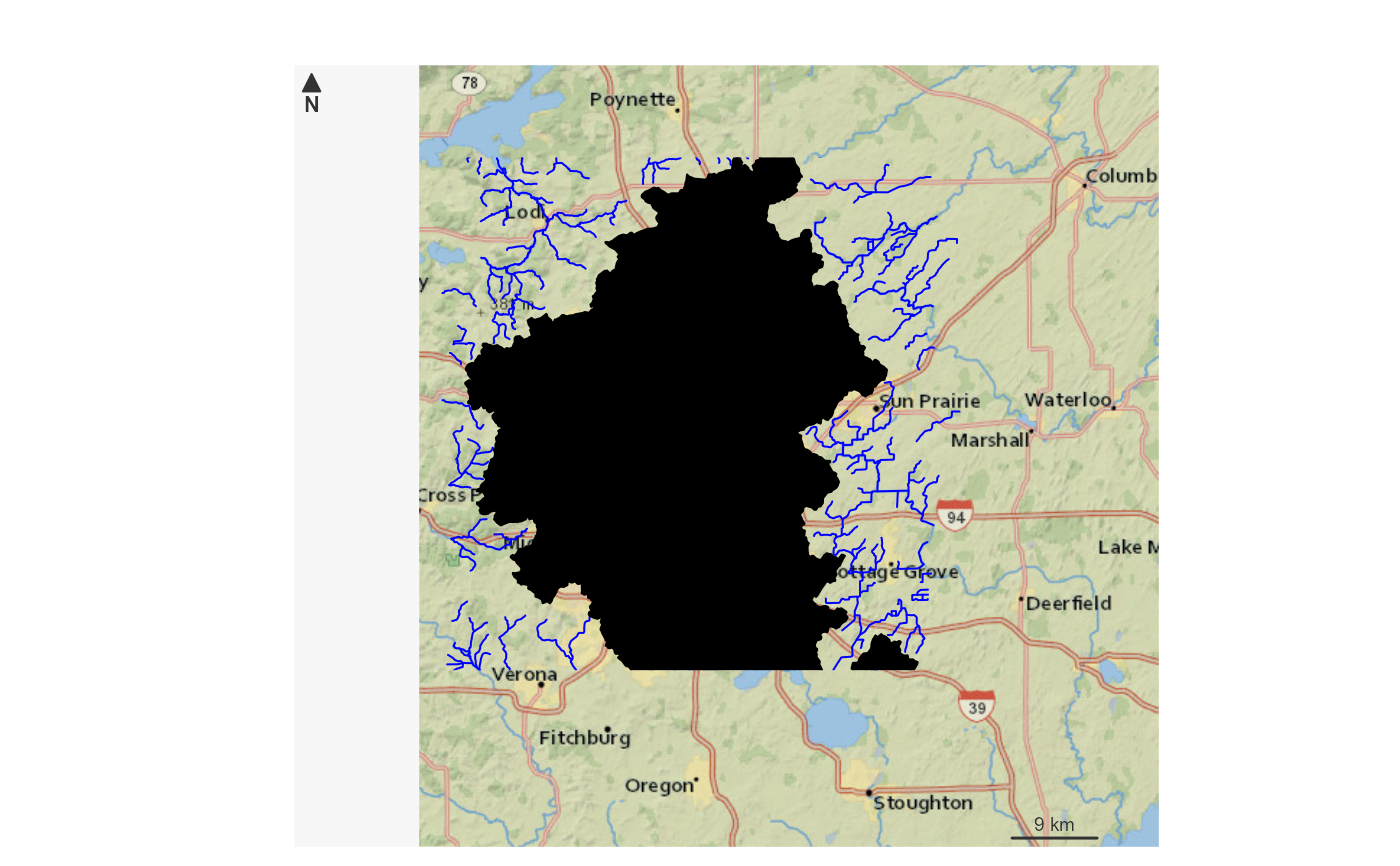
(catchment <- get_split_catchment(snap_point))

bbox <- sf::st_bbox(catchment) + c(-0.005, -0.005, 0.005, 0.005)

nhdplusTools::plot_nhdplus(bbox = bbox, cache_data = FALSE)

plot(sf::st_transform(sf::st_geometry(catchment)[2], 3857), add = TRUE, col = "black")
plot(sf::st_transform(sf::st_geometry(catchment)[1], 3857), add = TRUE, col = "red")
plot(sf::st_transform(sf::st_sfc(point, crs = 4326), 3857), add = TRUE, col = "white")

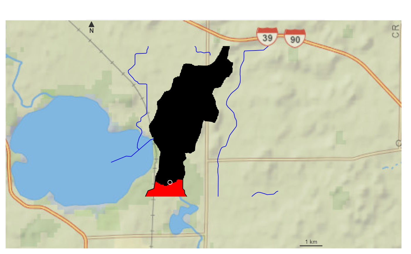
(catchment <- get_split_catchment(snap_point, upstream = FALSE))

bbox <- sf::st_bbox(catchment) + c(-0.005, -0.005, 0.005, 0.005)

nhdplusTools::plot_nhdplus(bbox = bbox, cache_data = FALSE)

plot(sf::st_transform(sf::st_geometry(catchment)[1], 3857), add = TRUE, col = "red")
plot(sf::st_transform(sf::st_geometry(catchment)[2], 3857), add = TRUE, col = "black")
plot(sf::st_transform(sf::st_sfc(point, crs = 4326), 3857), add = TRUE, col = "white")

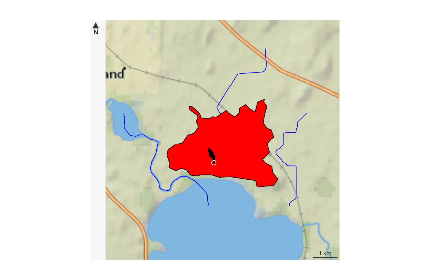
pour_point <- sf::st_sfc(sf::st_point(x = c(-89.25619, 42.98646)), crs = 4326)

(catchment <- get_split_catchment(pour_point, upstream = FALSE))

bbox <- sf::st_bbox(catchment) + c(-0.005, -0.005, 0.005, 0.005)

nhdplusTools::plot_nhdplus(bbox = bbox, cache_data = FALSE)

plot(sf::st_transform(sf::st_geometry(catchment)[1], 3857), add = TRUE, col = "red")
plot(sf::st_transform(sf::st_geometry(catchment)[2], 3857), add = TRUE, col = "black")
plot(sf::st_transform(sf::st_sfc(pour_point, crs = 4326), 3857), add = TRUE, col = "white")
}
#> Spherical geometry (s2) switched off
#> although coordinates are longitude/latitude, st_intersects assumes that they
#> are planar
#> Spherical geometry (s2) switched on
#> Zoom set to: 10
#> Spherical geometry (s2) switched off
#> although coordinates are longitude/latitude, st_intersects assumes that they
#> are planar
#> Spherical geometry (s2) switched on
#> Zoom set to: 12

#> Spherical geometry (s2) switched off
#> although coordinates are longitude/latitude, st_intersects assumes that they
#> are planar
#> Spherical geometry (s2) switched on
#> Zoom set to: 12


# }
# }